Highlights
- This high mountain land is incredibly remote, filled with quaint towns and intriguing architecture, great hiking trails, and fascinating cultural features.
- "Those who dream of crossing the Gobi desert or getting lost in the Cordillera Real will not regret a stay in Tusheti. Mountainous, aerial, remote, without electricity or running water outside Omalo, the region is a hotbed of strong sensations." (Nicolas Landru)
Introduction
Introduction:
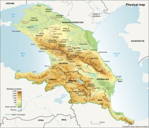
The Caucasus is famous for its majestic mountains, pristine glacial lakes, torrential rivers, waterfalls, lush forests and flourishing grasslands. This territory is located between the Black and Caspian Seas and is a natural bridge between Europe and Asia. It is a multicultural and multiethnic region with its own history and varied traditions.
There is an old legend that speaks of this region. When God was going to distribute the peoples over the world that he had just created, in an oversight, the salt shaker fell on what is today that land. It is the land of the mountain chain located in southeastern Europe, where about 60 different peoples live. Each of them speaks in their own language. That is why the ancient Greeks called this land “the mountain of tongues.”
The name of this region is related to Greek mythology. The Greek word Kaukasos was the name of a Scythian shepherd killed by Cronos and who gave these mountains their name. Kaukasos was also one of the pillars on which the world rested. Prometheus was chained in these mountains by Zeus.
Another version is the one that comes from the mythical character called Caucas, legendary ancestor of the people of the Caucasus. He this was the son of Targamos, and grandson of Japheth (third son of Noah) or Iapetus. His story was put in writing in a compilation of medieval Georgian chronicles, called Kartlis cxovreba (‘life of Kartli‘, center of the ancient and medieval region of Georgia, also known as Iberia, written from the oral tradition of the place .
On its southern slope coexist three countries that regained their independence in 1991 after the disintegration of the Soviet Union: Armenia, Georgia and Azerbaijan. The northern slope belongs to Russia and there are six autonomous republics: Chechnya, Ingushetia, Dagestan, Kabardino-Balkaria, Karachevo-Cherkessia and Adygea.
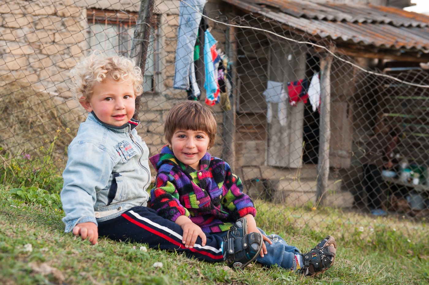
About 30 million people live in the Caucasian region. There are more than 60 different ethnic groups. The majority religion is the Orthodox Christian, but the Muslim minority is the majority in several regions. Chechnya and Ingushetia are related by their Muslim communities.
Brief general history of the Caucasus:
The northern zone is related to the plains of southern Russia and its peoples movements, such as the Scythians in the Old Age. The central area is where the original peoples of the Caucasus remain. In ancient times, the southern area was dominated by the Persians (only in the south, north of Iran), by the Greeks after the conquests of Alexander the Great, and later by the Romans to the south-west, and, to the south-east, by the Persians.
During the 8th and 9th centuries, varying parts of the southern Caucasus were occupied or in vassal relationship by Persia, Byzantium, and the Umayyad Caliphate. In the 13th and 14th centuries, it was the Seljuk Turks who invaded the area, especially the part that we know today as Azerbaijan (where they left their language), Armenia and Georgia.
During the 16th and 18th centuries the Caucasus was the subject of disputes between Iran (to the southeast) and the Ottoman Empire (to the southwest, and through its vassal the Crimean Khanate to the northwest). Russia came from the northeast to the Terek River in the time of Tsar Ivan the Terrible (mid-16th century), but in the 18th century it built a series of forts on the Azov-Mozdok line, defeated the Crimean Khanate (conquering the part located to the north of the Kuban River in 1783), and by the Treaty of Georguievsk, Imperial Russia took part of Georgia under its protectorate. From this treaty, the Russian government banned the languages of the area and imposed Russian, in a process of Russification, and began reforms that the population resisted.
During the First World War, the battles fought by the armies of Russia and Turkey took place in this area (Caucasus Campaign) and many ethnic groups fought on the side of the Turks.
The Second World War, during which some Wehrmacht units belonging to Army Group South, reached the region, waving the flag of Germany. Nazi on top of Mount Elbrus. Some members of ethnic groups in the area even formed special units within the SS, fighting either against the Red Army or against partisan groups in the Balkans or against the Western Allies.
In 1991, after the dissolution of the USSR the independence of Armenia, Georgia, and Azerbaijan was established.
In 1991, Chechnya declared its independence, prompting many non-Chechen residents to flee the area.
In 1993 hostilities began between the central Chechen government and the opposition. This caused that in 1994 Russia decided to intervene directly, starting intense bombardments against the Chechen capital, Grozny, causing great destruction in it and the departure of about 200,000 people from the area. Currently Russia suffers occasional attacks by terrorists in the region.
In 1992, just a year after the dissolution of the former USSR, inter-ethnic skirmishes began between the Ingush and North Ossetians, causing around 50,000 Ingusetians to flee the conflict zone, Prigorodni, in South Ossetia. North.
In 2008 a conflict broke out as Georgia tried to control the South Ossetia region; Russia came to the support of the Ossetians forcing the Georgians to retreat, occupying Gori and some other strategic points in Georgia such as Poti. With the mediation of the European Union the cessation of the fighting was achieved and the withdrawal of the Russian forces from the part of Georgia not included in South Ossetia or Abkhazia (this part is known by its English term Georgia Proper). As a consequence of the conflict, Russia decided to recognize Abkhazia and South Ossetia as independent countries.
(Source: https://www.ecured.cu/Cáucaso)
In Georgia specifically, its history dates back to the ancient kingdoms of Colchis and Iberia. Georgia reached the peak of its political and economic strength during the reign of David IV and Queen Tamar in the 11th and 12th centuries. At the beginning of the 19th century, Georgia was annexed by the Russian Empire. After a brief period of independence following the Russian Revolution of 1917, Georgia was annexed by Soviet Russia in 1921. From 1922 to 1991 the Georgian Soviet Socialist Republic was one of the fifteen federal republics of the Soviet Union. On April 9, 1991, shortly after the collapse of the USSR, Georgia declared its independence. Like many post-communist countries, Georgia suffered from the civil unrest and economic crisis of most of the 1990s, but through the Rose Revolution of 2003 the new government introduced democratic and economic reforms.
Relief:
It is a small country of approximately 69,700 square kilometers. Despite its small area, Georgia boasts one of the most diverse topographies of the former Soviet republics. Due to their height and poor transportation infrastructure, many mountain towns are virtually cut off from the outside world during the harsh winter.

The earthquakes and mountain landslides in these areas become characteristic and condition the lifestyle. Among the most recent natural disasters were the 1989 Ayaria rockslide, which displaced hundreds of people in southwestern Georgia, and two earthquakes in 1991 that destroyed several towns in the central and northern parts of the country as well as South Ossetia. .
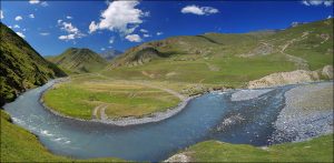
The largest river is the Mtkvari (or also known as Kura, the name given to it on the Azeri side), which after crossing Azerbaijan empties into the Caspian Sea after traveling 1,364 kilometers from the northeast of Turkey through the plains of Georgia and traverse the capital Tbilisi (Tbilisi). The Rioni River, the longest in the west of the country, flows down from the Greater Caucasus and empties into the Black Sea at the port of Poti.
Ecology:
The territory of Georgia is divided between four different ecoregions:
- The montane steppe of eastern Anatolia in the south, on the border with Turkey.
- Steppe and shrubby desert of Azerbaijan in the south, on the border with Azerbaijan.
- Hardwood forest of Ponto Euxino and Colchis on the Black Sea coast.
- Caucasus mixed forest in the rest of the country.
We will move into the mixed Caucasus Forest ecoregion:
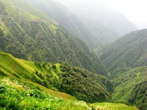
70% of this ecoregion, between 400 and 2,200 meters above sea level, is covered by temperate mixed forests; the dominant species are sessile oak (Quercus petraea), white hornbeam (Carpinus betulus), European chestnut (Castanea sativa), eastern beech (Fagus orientalis), and Caucasian oak (Quercus macranthera). At higher altitudes are species of birch and pine, as well as Caucasian fir (Abies nordmanniana) and oriental spruce (Picea orientalis).
At higher elevations, the forest is replaced by high alpine and subalpine meadows and meadows, alternating with thicket of the Caucasus rhododendron (Rhododendron caucasicum).
The most interesting fauna that you can find in Georgia is found in the great forests. You will see squirrels, deer, wild boar and, with a bit more luck and as long as you keep a good distance, you can also see bears, lynxes or wolves.
In the mountains, you can come across mouflon, chamois, mountain goats, wild cats, rams, foxes and badgers.
Among the birds, the pheasants and raptors stand out, among which vultures, eagles, hawks and circuses abound, not forgetting storks and pelicans.
Georgian cuisine
“Every Georgian dish is a poem,” wrote Alexander Pushkin. Nut-rich Georgian cuisine has benefited from the country’s legendary hospitality and its traditional location on the east-west trade routes, thus combining the best aspects of Mediterranean and Asian cuisine. Geopolitically, Russian-Georgian relations have been strained, but Moscow restaurants adore spicy meat stews, garlic aubergine dishes, and other distinctive tastes of great Georgian cuisine.
Tbilisi
Steinbeck said that Russians who had led a virtuous life did not go to heaven, but to Georgia. Tbilisi, its capital of one million inhabitants, offers us a journey back in time. At the same time a Persian caravan camp, a tsarist capital, a loot of Mongols, an Ottoman labyrinth and an old Soviet showcase that begins to fill with invasive skyscrapers. Geographically already in Asia, in its decline and in its simultaneous strength, it offers a decided image of a European city that is both exotic and familiar.
(Alberto Llamas, El País Journal)
Nowhere is the magic of Georgia’s past merged with its fight for the future better than in the Old City of Tbilisi, the capital of Georgia. Winding streets with gracefully sloping houses lead past ancient stone churches to shady squares and the ultra-modern Peace Bridge, spanning the Mtkvari River. Relaxed cafes and bohemian bars coexist with trendy lounge clubs, carpet shops, new hostels and cute little hotels. The ancient silhouette of the Nariqala fortress dominates everything, while the presidential palace, a work of the s. XXI, with its ovoid glass dome, looks out across the river.
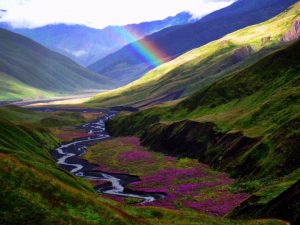
Tushetia
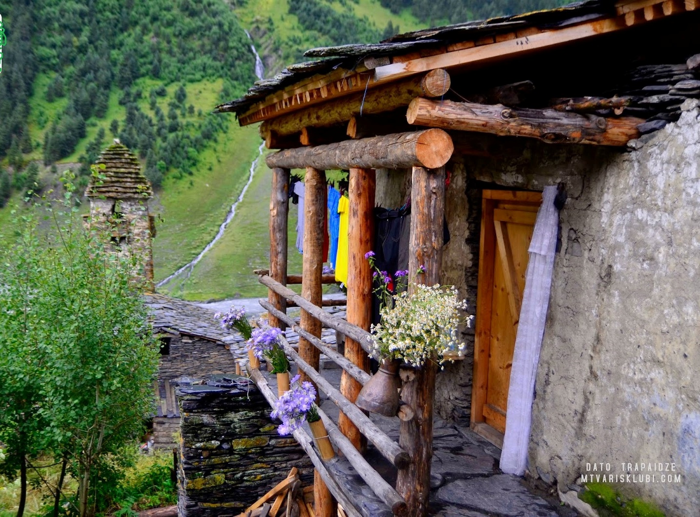
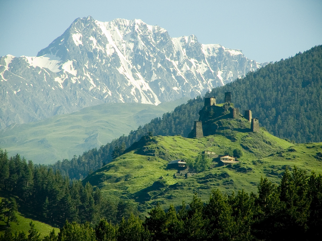
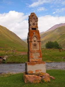
Our goal: Get to know while we explore remote Tusheti, an unspoiled high mountain region hidden in the far northeast of Georgia, on foot. The only road that goes to Tusheti, passing through the port of Abano (2900 m) from Kakheti, is only passable for ATVs from the beginning of June to the beginning of October. In this area we find vestiges of the ancient Tusheti animist religion such as the abundance of stone altars called khatebi.
Tusheti or Tushetia is a small, remote and mountainous historical region of the Caucasus, located in the northeast of Georgia, currently belonging to the administrative region – mjare – of Kajetia.
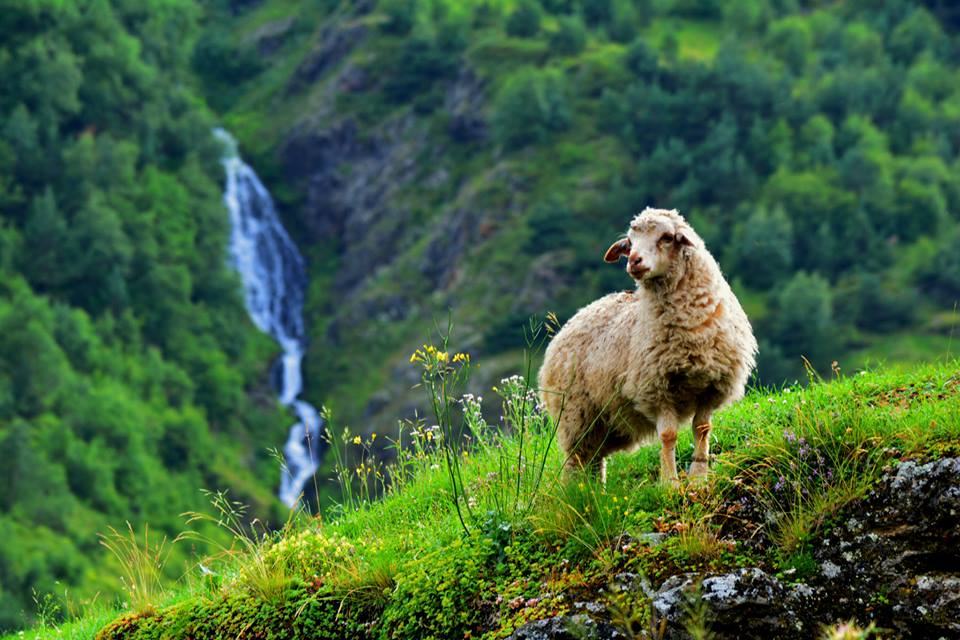
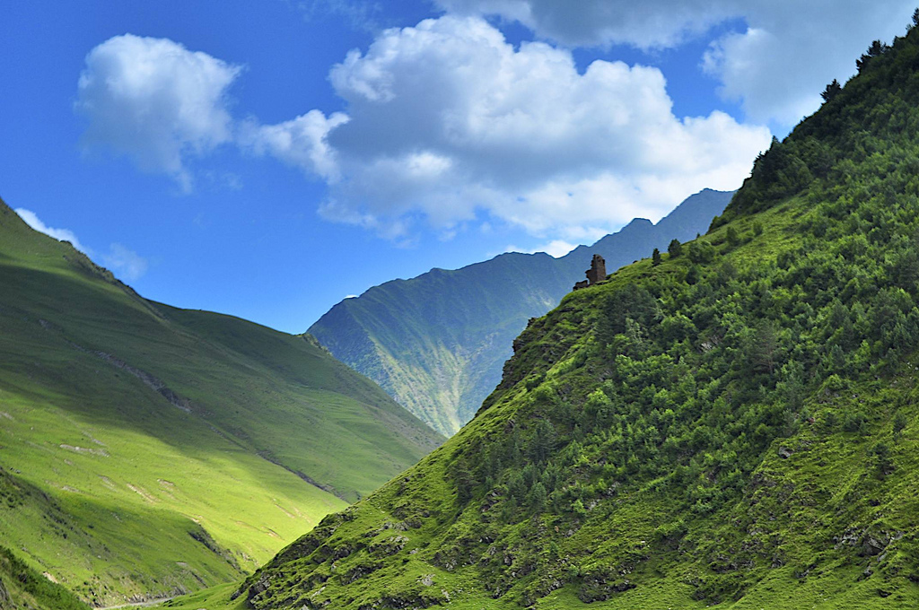
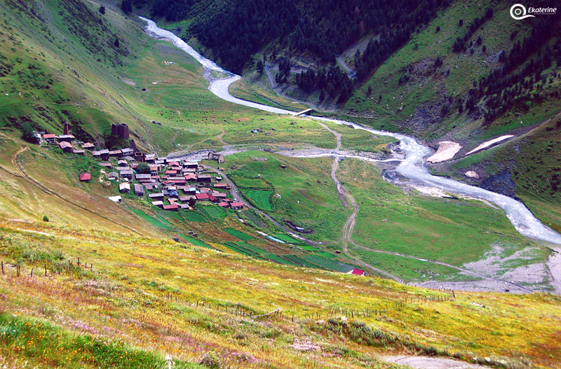
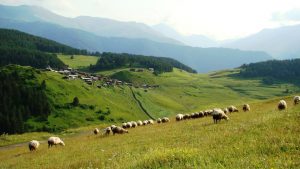
Tushetia and the neighboring regions of Khevsouretia and Pshavi, located on the northeastern border of Georgia, are still inaccessible regions (they do not have real access roads) that are true natural sanctuaries, one of the most ecologically virgin regions in the Caucasus. In the confines of Dagestan, from which it is separated by the Greater Caucasus, Tushetia is a land of shepherds who raise their sheep practicing transhumance (summer). It is a region still without electricity or telephone (in general) in which the towns are within hours of walking from each other and are only accessible by bridle paths, where the horse is still the main means of transport. Even 4x4s fare poorly in the region.
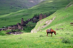
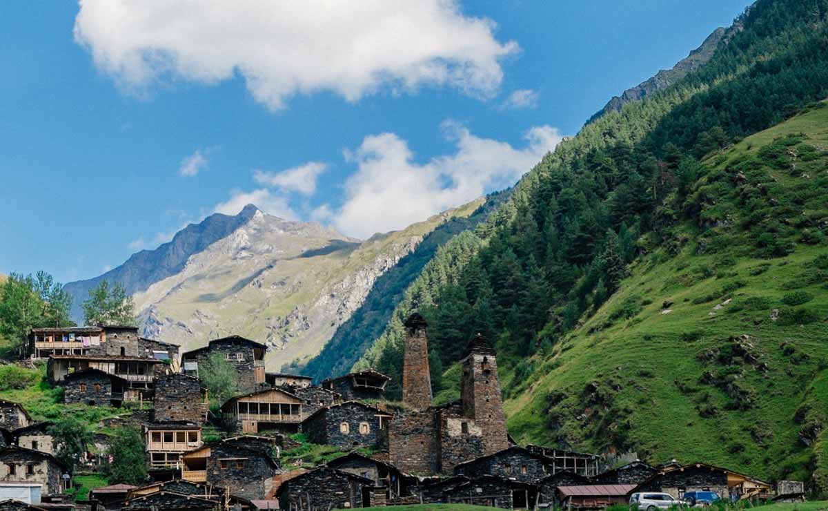
Omalo is the main town in the center of the region; it has an airfield. Tushetia is a great place for mountain hiking.

Geography
Situated on the northern slopes of the Greater Caucasus Mountains, Tushetia is bordered by the Russian republics of Chechnya and Dagestan, to the north and east, respectively; and through the historic Georgian provinces of Kajetia and Pshav-Khevsureti, to the south and west. The population of the area is mainly of the Georgian ethnic group of Tushs or Tushetianos (in Georgian, Tushebi).

Historically, the Tushetia comprised four distinct mountain communities, based on a geographic division of the region:
- in the west, the Tsova, the Bat peoples who live in the gorge of the Tsova River;
- in the south, the Gometsari, who live along the banks of the Alazani-Tushetis River;
- in the north, the Pirikiti [‘beyond the mountains’] who live along the banks of the Alazani-Pirikitis River;
- in the east, the Chaghma, who live near the confluence of both rivers, and are grouped in the main village of Omalo and other nearby towns.
Administratively, Tushetia belongs to the Ajmeta district (with 2,248 km² and 44,100 inhabitants in 2002), part of the Kajetia region of eastern Georgia. The largest town in Tushetia is Omalo.
History
The relative absence of historical sources prevents the writing of a true history of the region. The area would have been converted to Christianity, but it remained largely pagan (forming a unique syncretism between local mountain pagan beliefs and Georgian Orthodox Christianity). Long isolated from the rest of the world, the first vehicular road to enter Tushetia was built by the government of Georgia (Soviet at the time, since 1921) in the 1960s.
First settlers
The area is believed to have long been inhabited by the Tush, a subgroup of the Georgians, who in turn were divided into two groups: the Chaghma-tush (Georgian name, used for the Tush who speak the local Georgian dialect) and the tsova-tush (Naj speakers, better known as bats or batsi). It is unclear if the ethnic Georgians got there first or if the bats did.

There are two main theories about the origin of bats, with several variations. One is that the bats are the remnant of a great Naj-speaking people. Amjad Jaimoukha speculates that they were descendants of the Kakh, a historical people who lived in Kajetia and Tushetia, who apparently called themselves Kabatsa. However, the belief that the Kakh were originally Naj is not widespread. The Georgian name of the bats, the tsova-tush, may also (or instead) be linked to the Tsov, another historical Naj people that the Georgian historian Melikishvilli argues would have ruled the kingdom of Sophene in Urartu (called Tsobena in Georgian ) and were apparently forcibly transferred to the region around Erebuni, a region linked to the Naj peoples by place names and diverse historiography. However, theories linking the Bats to the peoples of Transcaucasia are not universally accepted.
The second theory holds that the Batsi would have crossed the Caucasus mountain range from Ingushetia in the 17th century and that, finally, they would have settled in Tushetia, and that, therefore, they would be a tribe of Ingush origin that was Christianized and Georgianized for centuries.
Bats have considered themselves to be part of the Georgian nation for a long period of time and have spoken Georgian in that same time. The assimilation process of the bats continues, but many bats have stuck to their native language and speak Georgian as well, causing a massive Georgian influence on their language. They are Georgian Orthodox Christians.
In the 330s, many pagan Georgians from Pkhovi took refuge in the uninhabited mountains during their rebellion against Christianization by the Iberian King Mirian III. Later, they were forcibly converted to Christianity and subdued by the Georgian kings.
After the collapse of the unified Georgian monarchy, Tusheti fell under the rule of the Kajetian kings in the 15th century.
During the German invasion (Operation Barbarossa) of the Soviet Union, a minor anti-Soviet revolt took place in the area in 1942-1943, apparently linked to similar but larger-scale events in neighboring Ingushetia.
Abandonment of Tushetia and migration to Kajetia
The Kajetia plain was used for a long time as a winter grazing place and gradually became an intermediate station, halfway between the transhumance pastures and the Chiraquia plain. In the middle of the 19th century, a part of the population began to settle there in winter, occupying the Tushetia villages only in summer. Many Tush families began moving south from Tushetia during the first half of the 19th century and settled in the low Alvan fields at the western end of Kajetia. Many of these families practiced a semi-nomadic way of life: the men spent the summer with the flocks of sheep high in the mountains between April and October, and wintering with their flocks in Kajetia.
Alvan had belonged to the Tush as a wintering ground for their cattle for centuries; It was only bequeathed to them in the 17th century, in recognition of their valuable help in defeating a Persian army at the Battle of Bakhtrioni in 1659:
«Like a rushing current the Tushetians poured into the fortress, while the first rays of the rising sun fell on the ancient shadowy fortifications. The Tatars, half asleep, ran out into the field, but to no avail, for then they encountered the pchaves and khevsoures, who had ventured out of Pankisse’s gorge. The Tartars, surrounded on all sides, were exterminated to the last».
The first were the clan tush, or subject of Tsova, who owned the largest herds in the smallest territory. The Bats people left after the destruction of one of their most important towns by a landslide around 1830 and an outbreak of plague, giving rise to the founding of the town of Zemo Alvani. After them came those from the Pirikiti thème. The village of Kvemo Alvani was later created by the Gometsari, while the Tchagma founded the village of Lalisq’ur.
The Tushetios
Traditionally, the Tushetios were herders of sheep. Tushetian gouda (cheese) and high-quality wool were famous and exported to Europe and Russia. Even today sheep and livestock are the main activities of the Tusheti highland economy. Local herders spend the summer months in the upper Tusheti areas but live in the lowland villages of Zemo Alvani and Kvemo Alvani in winter. Their customs and traditions are similar to those of other eastern Georgian mountain peoples.
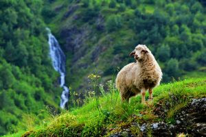
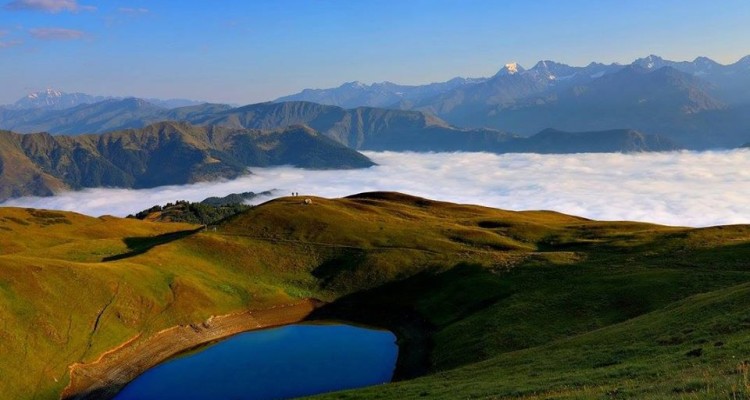
One of the most ecologically unspoiled regions in the Caucasus, Tusheti is a popular mountain location for hiking.
Pork is taboo in Tusheti. Farmers do not raise pigs and travelers are advised not to bring any pigs to the region. However the locals eat pork when they are not in Tusheti.
DOCUMENTATION NEEDED TO TRAVEL TO GEORGIA
- To travel to Georgia from Spain or any country in the European Union, it is not necessary to obtain any visa. This is valid for trips of up to a full year. On the other hand, foreigners legally residing in Spain, or foreigners with a valid Spanish visa, may visit Georgia without the need for a visa issued by Georgian authorities. Although this is valid for stays of a maximum of 90 days.
ADDITIONAL INFORMATION
- It is not allowed to enter the churches with shorts
- Women must wear a headscarf / veil in Orthodox churches
- Accommodation in base camp (tents): 1 x night to Girevi 1 x night to Khvakhida 1 x night to Atsunta 1 x night to Khonichala
- Meals 3 x breakfast / 6 x picnic / 2 x lunch / 3 x dinner
- Amaroq Explorers / Local Guide (days of trekking)
- Horses for luggage
- Cook
- Tents
- One bottle of water per day / person
- Activities according to the program
- Accident and RC insurance
- Taxes
- Travel insurance
- Excess baggage
- Personal gear / clothing, sleeping bag, backpack, warm clothing, etc. Contact us for advice
- Services not mentioned in "included "
-
Spain / Tbilisi
Arrival at Tbilisi airport, meeting with the company representative and transfer to the Tbilisi Hotel.
-
Tbilisi / Telavi Tour (100 km)
After breakfast we will have a guided tour of the city of Tbilisi.
They will be unforgettable hours of familiarization with the capital. A charming town built in the 5th century along the winding valley of the Mtkvari River. All places of interest are very close to each other, just a few minutes walk away.
We start the excursion from the medieval Meteji church (13th century), we will go up in cable cars to the Narikala fortress (4th century) that dominates the skyline of the old town. We continue to explore the brick-domed, oriental-style underground sulfur baths (17th century) – the naturally hot mineral water district. We will walk through the center discovering Shardeni street with its attractive cafes and galleries that will catch your attention. We will visit the synagogue, the Sioni cathedral, the Anchisjati basilica (6th century).
Finally, the circuit will take us to the main avenue of Rustaveli where we will see the Parliament, the Opera, the Ballet and the Tbilisi Theater, which will provide you with a cosmopolitan atmosphere.
Visit to the National Museum of artisan goldsmithing dating from the 3rd millennium BC.
Departure for Telavi.
Dinner and accommodation at the hotel in Telavi. (D / – / C)
-
Telavi / Alaverdi / Omalo
After breakfast we will drive to Alaverdi Cathedral (11th century). Parts of the monastery date back to the 6th century, but the current cathedral was built in the 11th century by Kvirike III of Kajetia. Alaverdi is one of the tallest cathedrals in Georgia (50 m.). It dominates the surrounding landscape in a fertile river valley against the backdrop of the Caucasus Mountains.
After the visit, the journey to the Tusheti region begins. The route is inscribed on the UNESCO indicative list. To get to Tusheti, you have to pass the Abano pass, with a height of almost 3,000 meters above sea level.
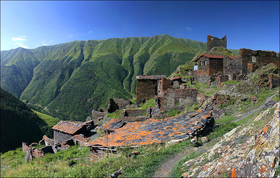
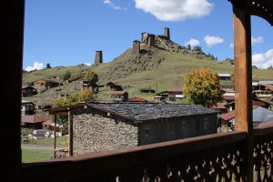
Arrival at the village of Omalo with a height of 1880m.s.n.m. We will have a picnic along the way. We will visit on foot the upper part of the town (Zemo Omalo) that has a magnificent set of medieval towers (keseloebi).
Dinner with traditional dishes and accommodation at the guest house (with basic services and friendly conditions).
(D / PL / C)
-
Dartlo / Chesho / Parsma / Girevi
Breakfast.
Early in the morning, we will take the road that will take us to the remote villages of Tusheti, far from civilization and inhabited by local shepherds and their families.
Traces of the ancient animist religion are still evident, in particular the stone “Jati” temples covered with horns of slaughtered goats and sheep, where time seems to have stood still.
En route we will have a picnic.
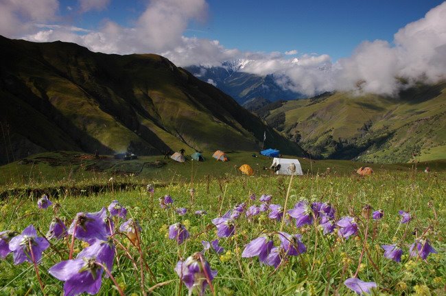
Dinner and overnight at the camp. (D / PL / C)
Elevation: ↓ 200 ↑ 200 m
Hiking time: 6-7 hours
Distance: 15 km
-
Girevi / Kvakhida
Breakfast.
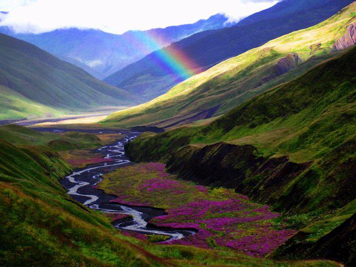
Today we cross one of the most beautiful valleys in Tusheti. We will walk in the intense green and crossing the fields full of fragrant flowers and arriving at the top of the hill we can enjoy the alpine landscapes and the views of the villages.
En route we will have a picnic.
Dinner and overnight at the camp. (D / PL / C)
Elevation: ↑ 50 m ↓ 450
Hiking time: 6-7 hours
Distance: 16 km
-
Kvakhida / Passo di Atsunta
Breakfast. We will take the path that will take us to the Atsunta pass (3480 m) located between the two historical provinces of Tusheti and Jevsureti. We will be close to the border with Chechnya. En route we will have a picnic. Dinner and accommodation at the camp. (D / PL / C)
Elevation: ↓ 400 ↑ 1000 m
Hiking time: 7-8 hours
Distance: 14 km
-
Atsunta / Jonichala
After breakfast we will begin the descent on the opposite side of the slope that will take us to the Khonichalain Jevsureti village.
Jevsureti is another historical province of Georgia in the Greater Caucasus, where the mountains are harder and during the year the roads are closed for 6 months; Here we find the richness of traditions and the unique blend of Georgian Orthodox Christianity and pre-Christian cults.
En route we will have a picnic.
Dinner and overnight at the camp. (C / PL / C)
Elevation: ↓ 950
Hiking time: 4-5 hours
Distance: 13 km
-
Jonichala / Mutso / Shatili
Breakfast.
In the morning we will spend time visiting two more mysterious villages of Jevsureti.
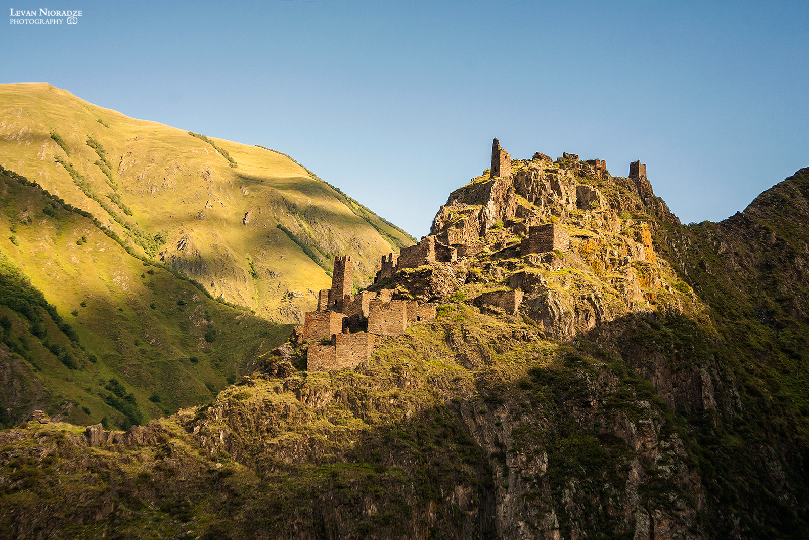
Mutso Villages (1880 m) – Once a major stronghold of the region, Mutso is now completely abandoned. The village is home to approximately 30 units of fortified medieval dwellings arranged on vertical terraces over the Mutso-Ardoti gorge.
Another more spectacular town is Shatili, located in the deep Arghuni Gorge. The town is a unique complex of medieval and early modern fortresses and stone and mortar fortified dwellings that functioned as residential areas and fortresses that protected the northeastern outskirts of the country. The fortress consists of about 60 towers that are grouped together to create a single chain of fortifications.
En route we will have a picnic.
Dinner and accommodation at the guest house. (D / PL / C)
Elevation: ↓ 4600
Hiking time: 5-6 hours
Distance: 15 km
-
Shatili / Mtskheta / Tbilisi (150 km)
After breakfast, departure by car to return to Tbilisi.
We will travel through the Piraketa Jevsureti valley. Through the Datvisjvari pass (2676m) from where we can enjoy picturesque landscapes.
We will arrive at Mtsjeta– the former capital of the Kingdom of Georgia – UNESCO heritage, which is located at the intersection of the military road and the Silk Road. We will see the Svetitskhoveli Cathedral (11th century) which is one of the most important cultural, artistic and architectural monuments in Georgia where the robe of Christ was buried and for centuries it has been the place of coronation of kings and patriarchs of Georgia, weddings and royal christenings.
We will continue our journey visiting the 6th century Dshvari (cross) Monastery. Built at the same point Santa Nino had erected a wooden cross to celebrate Iberia’s conversion to Christianity. The Dshvari Church had a great impact on the development of Georgian architecture and served as a model for many other churches.
Lunch in a traditional restaurant where we will have Georgian wine tasting.
Overnight at the hotel. (B/L/-)
-
Departure
Airport transfer.
End of the program